The wind was howling when I awoke and it looked like a wild day to be out walking. It was enough to make us question the sanity of heading into the bush, but not enough to stop us from going! Kaz and I drove to Medlow Bath and started down the Pilcher Track shortly before 9am. I was puzzled when we arrived at a transmission tower a few moments later as it didn’t look at all familiar. Nevertheless we continued on our merry way, with the track descending more sharply than I remembered. After consulting the map in a rather befuddled kind of way, we continued on and soon found the main track. Phew! With pride intact, I realised that we’d taken the ‘wrong’ branch of the fire trail at the start, but luckily both roads lead in the same direction. I felt somewhat vindicated on my return home to learn that the Pilcher Track is marked incorrectly on the map, which no doubt contributed to our confusion!
The last time I was down this way was in springtime and it was like walking through a forest of flowers. Absolutely gorgeous in wildflower season, but a pretty little track at any time of year – so undramatic, and yet such a surprising little pass into the Grand Canyon. The track hugs along the cliffline for a short while, and then with a hop, skip and a jump you’re magically in the canyon itself.

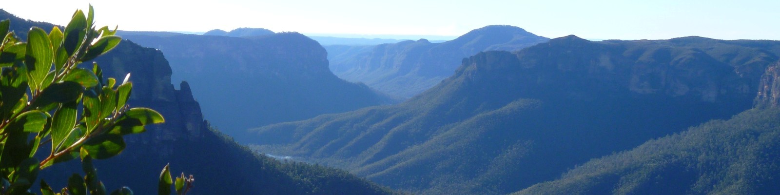
Our first waterfall of the day was in the Grand Canyon, where the light was turning the water into sheets of silky gauze. I kept thinking I could hear voices echoing from the canyon walls, but Kaz was convinced it was just the trees rubbing their trunks together in the wind. After enjoying the picturesque fernery and delightful stepping stones of the canyon, we turned onto Rodriguez Pass, and continued following Greaves Creek as it makes its way into the valley. The creek drops more steeply here and there are many small cascades. It was surprising how warm and sheltered it was once we’d descended into the protected confines of the Grose Valley.

We were so busy chatting that I forgot to keep an eye out for a good place to leave the track and head towards the junction with Govetts Creek. So it wasn’t until we met the creek, just below the junction, that I remembered where we were going. After hopping across to the north side of Govetts Creek, we found ourselves in a beautiful Turpentine forest. There is a small campsite here, with all the hallmarks of a boy scout camp, that I believe is known as ‘Syncarpia’.

We then crossed back over to the south side of the creek, where we discovered a rough track. I had never ventured upstream from the junction before, but had heard there were some pretty waterfalls. I was expecting it to be more of a footpad, but this looked to have been quite a well developed track at one point in time. Apparently it was a popular destination for walking parties in the early 1900’s.

We picked our way slowly upstream, passing through the impressive Blackwall Glen before coming to the very pretty Edenderry Falls. What a marvellous swimming hole! I can’t say I was tempted by a swim in the middle of winter, but this would be a gorgeous place to visit in summertime.

We were both keen to continue on to Hilary Falls, only a short distance further upstream. Kaz led us up what was probably the steepest route possible, while I muttered under my breath about dodgy scrambles, but we did find some wonderfully large orchids along the way.

We stopped for lunch just shy of the falls on a nice, sunny slab of rock. Here we enjoyed our toasted sandwiches (still warm!) and the views from this high point above the creek. Unbeknown to us we were extremely close to our destination, so after continuing only a short distance we were greeted with the rather lovely Hilary Falls cascading into a clear pool.

Kaz, queen of adventure, was keen to climb to the top of the falls. This gave us a completely different perspective and offered lovely views up and down the valley. It might be an interesting summer trip to continue upstream all the way to Arethusa Falls, but I suspect it would involve a lot of thick scrub, so not for the faint-hearted!

On returning downstream we managed to follow a track pretty much all the way to the junction, so the going was a lot easier. The small group of walkers we encountered as we emerged onto the main thoroughfare of Rodriguez Pass seemed convinced we were lost, despite assurances to the contrary. They were among only a handful of people we saw all day.

Less than one kilometre further downstream we came to the foot of the Horse Track. Since my first encounter with this old bridle trail, I’ve been very fond of this route out of the valley. It’s the kind of climb I love – nice, easy gradients that allow me to plod upwards at a steady pace. For some strange reason its use is actively discouraged by the NPWS and the map is marked “Caution: track not maintained”. Despite these warnings it is in excellent condition and very straightforward to navigate. But today my legs felt leaden and I hauled myself up at an excruciatingly slow pace. When I finally arrived at the top Kaz was waiting for me with some hot miso soup. We paused awhile to take in the view and enjoy the sounds of a particularly vocal lyrebird. I was surprised by the clear view we had from here of Blackwall Glen, a striking wall of shale rising above the creekline.

All that remained to end our splendid day was a short walk back through the Grand Canyon, and then to retrace our steps up the Pilcher Track. Thank you Kaz for a great day out exploring!