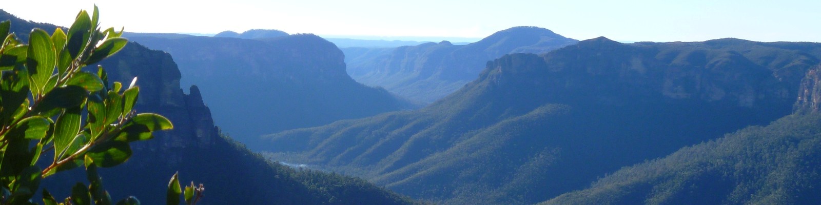
We were going a bit stir-crazy at home, so I bundled the kids in the car and we headed out to McMahon’s Point for a short walk and a picnic. This spot is out on Kings Tableland, about 20km past the old Queen Victoria hospital. From the carpark it is an easy 800m walk through damp fern forests to the lookout, where there are panoramic views into the Kanangra-Boyd Wilderness Area and out over Lake Burragorang.

We ate our homemade sushi while perched on a rock, soaking up the winter sunshine. It was very cold in the shady forest areas, at a guess not more than five degrees, but lovely in the sun. I have recently discovered that there used to be a road from here, down into the valley, that was used as an access route for the Burragorang farming community in the early 1900s. I dragged the kids along a very overgrown track that I’m guessing is the old road, but we didn’t make it very far before the fallen trees proved too challenging for small legs. There is apparently some beautiful stonework on the bridges and culverts along this road, but unfortunately it lies within the 3km exclusion zone around the Warragamba water supply.

With wilderness stretching as far as the eye can see, it is hard to imagine how this valley would have looked prior to the 1950s when the dam was built. Old photos show a patchwork landscape of cleared farmlands that were home to an isolated and close-knit community. While the still, blue waters of Lake Burragorang have a serene beauty, I feel a sadness for the people who grew up in the valley and witnessed such a complete transformation of their homelands.